Going the distance: The 10 best mapping apps for Android
The easiest way to get from A to G then back to B

Sign up for breaking news, reviews, opinion, top tech deals, and more.
You are now subscribed
Your newsletter sign-up was successful
Need a guide through the maze of mapping apps out there? Lost in a Spaghetti Junction of software? Go straight ahead for two sentences. Ignore this one. You have reached your destination.
There are loads of reasons to use a smartphone - but one of the best is to get from A to B. Android really has that sewn up for the basics, but there's loads more to be gained from having a quick run through the Google Play Store.
So check out our rundown of the best apps to get where you want to go, see the best things or explore the night sky... just remember to send us a postcard.
Google Maps
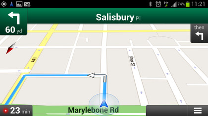
The world belongs to Google now, so who better to guide you through it? The app already offers voice-guided turn-by-turn navigation, live traffic info, Street View and indoor maps for major stores, hotels and airports, with increased personalisation just announced.
Navfree
This open-source satnav lets you download route maps before you start a journey, so you don't need a data connection once you're on the road, something that still trumps Google Maps. Its various routing options including walking routes, and automatic redirection whenever you take a wrong turn.
Sign up for breaking news, reviews, opinion, top tech deals, and more.
Outdoor Navigation
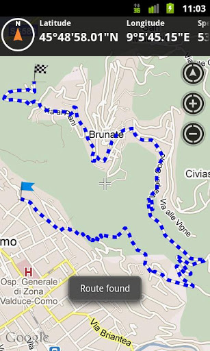
Aimed at hikers, bikers, joggers and doggers (probably), this route planner uses Google Maps and others to help you find your way through the woods. Maps display latitude, longitude and a digital compass, while stats track your progress, speed, etc.
Maverick GPS Navigation
Another good option when going off-road, Maverick lets you scroll through a wide range of online maps then caches them for use offline.
Save and share options include Google-friendly GPX route recording, so everyone can see exactly where you've been.
GPS Essentials
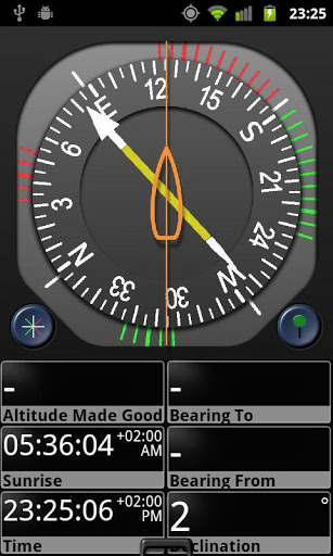
Casual travellers will be overwhelmed by the wealth of data, but hardcore navigators will feel they were headed here all along.
A customisable dashboard offers 45 widgets, ranging from altitude, bearing, declination and distance to latitude, longitude, sunrise, moonrise and more.
Tube Map Live Underground
The iconic London Underground map is a classic of no-nonsense navigation and this is the best of many Android apps to give it an interactive update, with a GPS station finder and route planner, live arrivals and departures and more.
Boat Beacon AIS Navigation
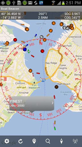
Offering basic marine navigation, this clever app uses AIS (Automatic Identification System) data to keep you apprised of your place on the water in relation to other vessels, up to 12 miles off the coast in the UK and US.
StarStruck Navigation
Taking the art of navigation right back to its roots, this app determines your location by the stars and planets in the night sky.
Using your smartphone's sensors as a makeshift sextant, it's a fun and battery-friendly alternative to GPS.
Soviet Military Maps Free
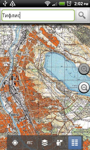
This app delivers exactly what it says on the (Pu)tin: cold war topography from behind the iron curtain.
Though mostly complied in the 1980s, its coverage of Africa and Asia offers details Google is yet to get to grips with.
Plus: just look at it. LOOK AT IT. It's more detailed than you can ever hope to see, and reminds us of the long car journeys where looking at the map was the only thing to keep us entertained.
Geocaching
A modern take on the treasure map, the official app of Geocaching.com includes coordinates for close to two million hidden containers around the world, with options to sort by difficulty or location. A great way to discover this GPS-based hobby.