


Hurricanes are best known for hitting the Caribbean and southern United States in summer and autumn, where the warm seas provide the energy that storms need to build up extraordinary power. But in the last decades, we've begun to see more tropical cyclones emerge in more unusual locations.
The record-breaking 2005 hurricane season saw Katrina and Rita hit the United States, but it also saw the unusual Hurricane Vince form over the North Atlantic and barrel into Spain and Portugal – the first storm to do so since 1842.
This year, however, we've been confronted with an even weirder phenomenon - Hurricane Ophelia. Ophelia didn't begin in the tropics at all - it began life as a decaying cold front over the North Atlantic in early October.
Ex-Hurricane
The storm sat in place for a few days, rapidly strengthening into a hurricane. First, category one was achieved, then two, then on 14 October Ophelia became the easternmost hurricane ever recorded to hit category three - indicating winds of more than 110 miles per hour.
The storm then tracked north-east, heading for Spain and Portugal. But at the last moment it shifted to a more northward trajectory, aimed at the west coast of Ireland. The more northerly waters are cooler, and so the storm has been starved enough to downgrade it below hurricane status, but it's still likely to be the strongest to hit the British Isles in at least 50 years.
“By the time Ophelia reaches our latitudes, she will be weakening and will be an ex-hurricane,“ said Met Office chief forecaster Steve Ramsdale. ”However, Ex-Ophelia will be bringing some significant impacts to Northern Ireland and western and northern Britain on Monday and Tuesday.
Those impacts have already included wind gusts above 100 miles per hour, as well as heavy seas. At the time of writing, the UK Met Office has a string of weather warnings issued across much of the west of the country.
More to come
It's impossible to link Ophelia and other unusual hurricanes directly with climate change, because they're just single events. But sea level rise and increasing sea surface temperatures make for more damaging storms, and both of those phenomena are a part of climate change. So it's fair to say that we can expect stronger storms in the coming years.
If you'd like to track the former hurricane online, the best places are the Met Eireann and the UK Met Office websites. The Guardian is running a liveblog, Meteoalarm has summaries of all the weather warnings across the whole of Europe, while Accuweather has a great interactive hurricane tracker where you can see the history of the storm.
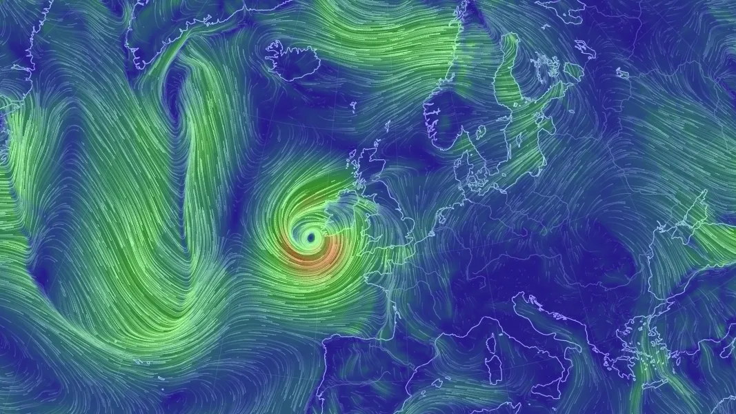
Last but not least, Nullschool's wind visualisation page is a visually-arresting way to follow Ophelia's progress (pictured above).
