Google Maps AI upgrades could solve your EV charging headaches
Find the nearest charging station

It’s a big day for Google Maps. First, the 3D buildings layer is rolling out to all Android users after months of waiting. And now we’re learning the app is expanding its eco-friendly features by introducing new ways to find EV charging stations and "lower-carbon travel alternatives”. The former, according to the announcement, aims to help electric vehicle owners map out those long road trips for the summer.
First, text summaries will appear in Google Maps describing the exact location of a nearby charging station. The tool utilizes artificial intelligence to take “helpful information from user reviews” to build directions below the name of a charger. As the company explains, you'll see step-by-step instructions telling you to drive down into an underground parking lot, follow the signs, and turn right just before you exit to find a station.
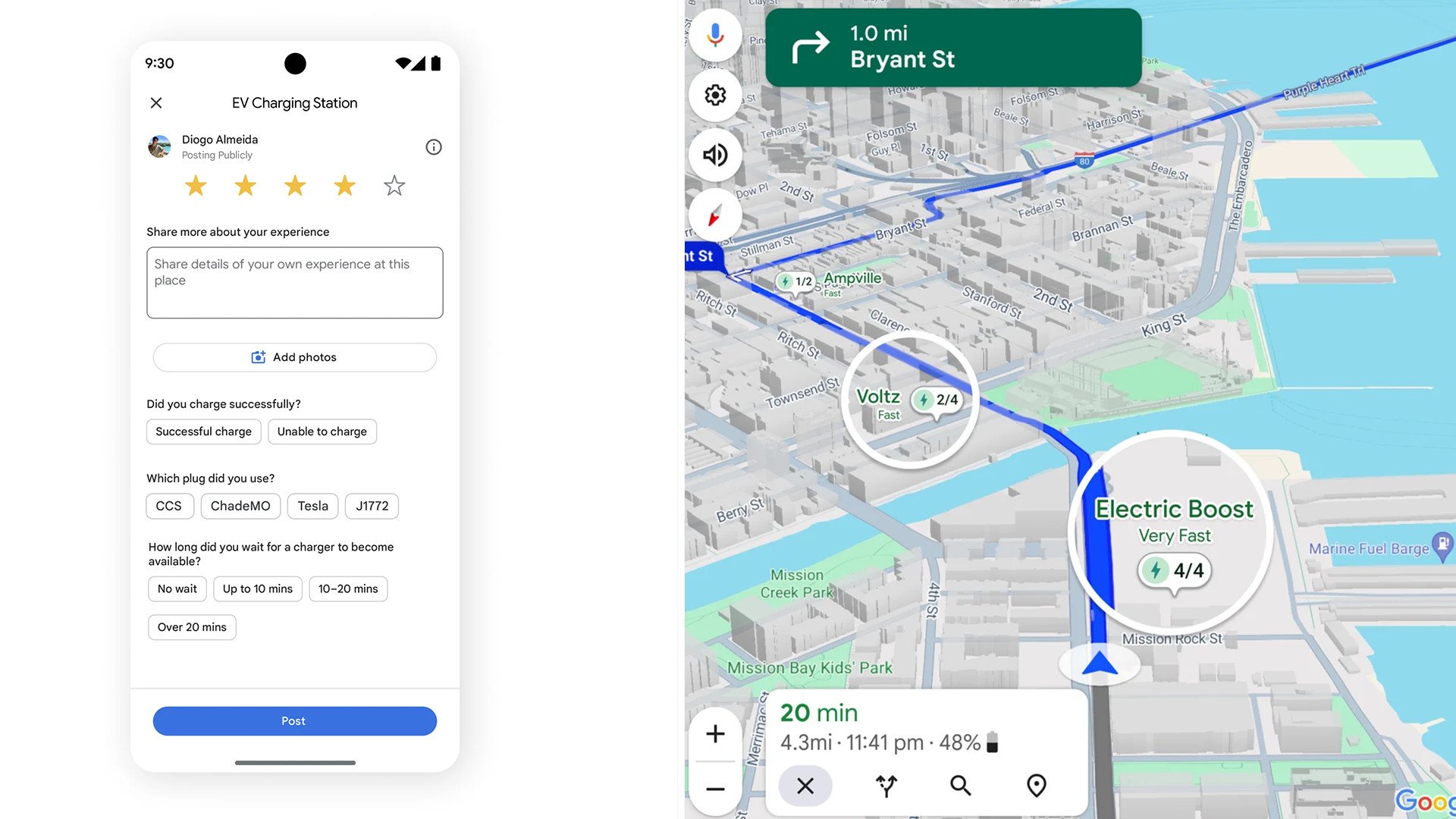
The company explains that since it sources from the community, generated summaries are “accurate and up-to-date”. To continue feeding the feature, reviews for charging stations will ask for extra details from the type of plug you used to how long you spent waiting.

While driving in your EV, Google Maps will highlight nearby chargers on your car's dashboard display. Indicators provide the name of the station, how many ports are open at a given time, and the ports' charging speeds.
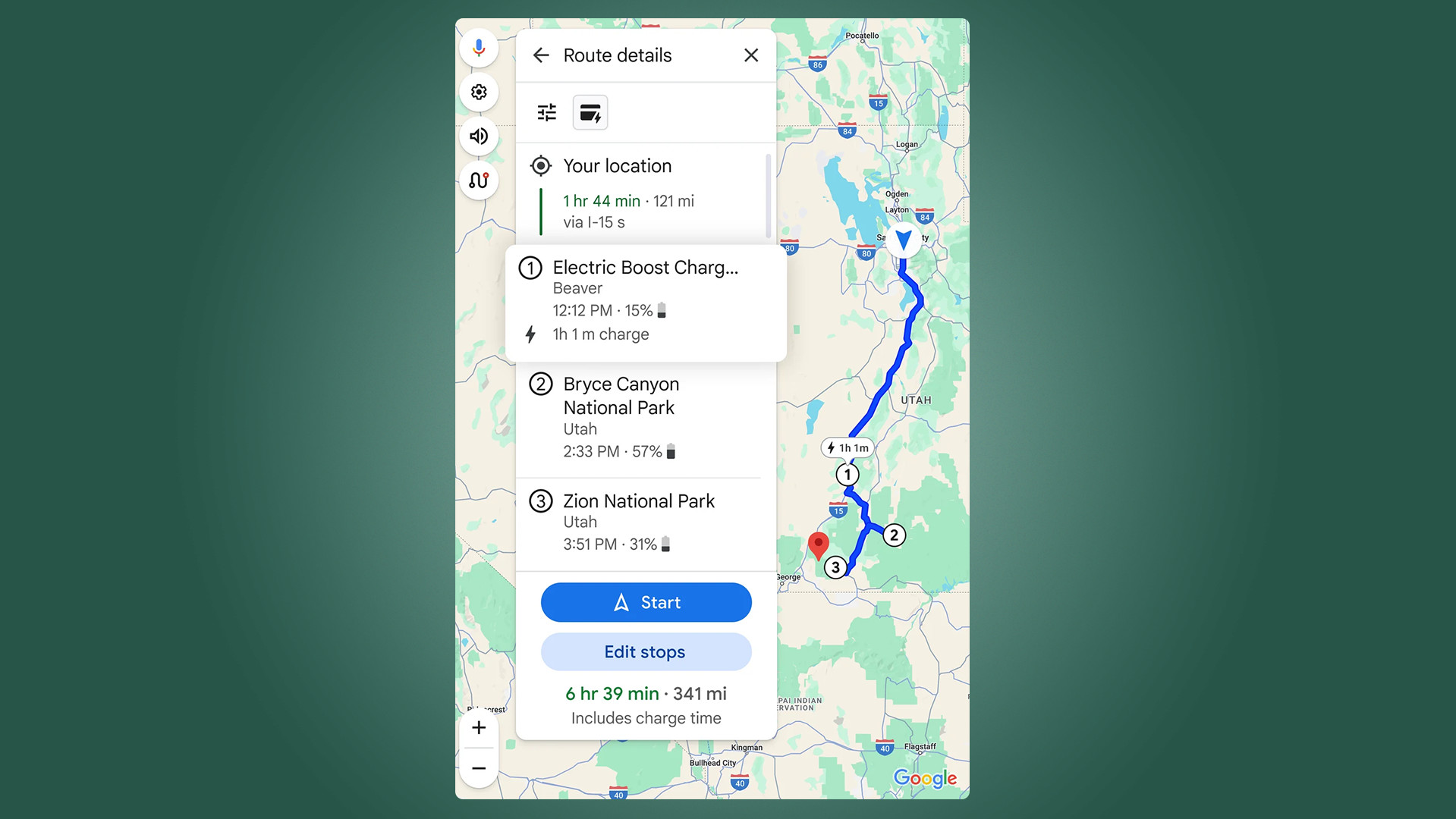
Lastly, Google Maps will recommend the best charging locations for people taking multi-stop trips. The suggestions it makes depend on your EV’s battery level. For example, if the car is fully charged, the app will point out stations nearer your destination rather than the ones closer to you.
Everything you see here is scheduled to roll out within the coming months, but their availability differs. Review summaries will be available on the mobile app while the charging station indicators and suggestions will be exclusive to vehicles with built-in Google software.

Google Search's travel update
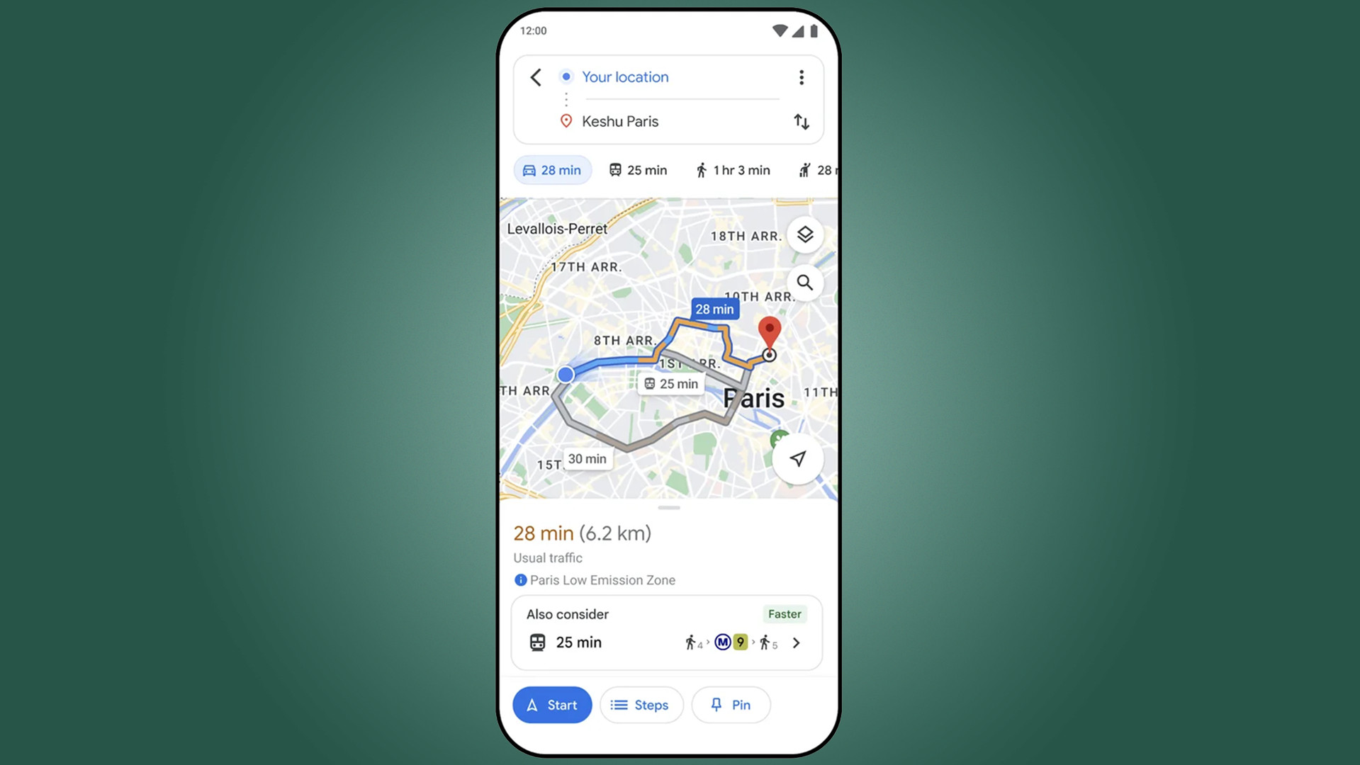
The other half of the patch will see Google Maps make “public transit or walking suggestions” below driving routes – so long as travel times are “practical.” It won’t recommend you hop on a bus if it takes longer to go from point A to point B. This feature is receiving a limited rollout as it’s only being released for around 15 cities around the world including London, Paris, and Sydney.
Sign up for breaking news, reviews, opinion, top tech deals, and more.

Google Search is also getting a travel-centric update. The search engine began adding information for long-distance train routes into results back in 2022. Moving forward, these details will include schedules and ticket prices with a purchase link on the side. What’s more, long-distance bus routes are going to be present too.
The new train data on Search is now available across 38 countries such as the US, UK, Australia, Canada, and Spain. The bus route info, on the other hand, is seeing a more limited release as it'll only show up in 15 global regions, including the United States, France, and Germany.
Be sure to check out TechRadar's list of the 10 things you didn't know Google Maps could do if you want to learn about all the neat tricks.
You might also like

Cesar Cadenas has been writing about the tech industry for several years now specializing in consumer electronics, entertainment devices, Windows, and the gaming industry. But he’s also passionate about smartphones, GPUs, and cybersecurity.