


Google Maps has expanded the number of locations upgraded with new high resolution satellite imagery and among them is London's Olympic Park.
In a post on the Google Lat Long blog, the company says the aerial, satellite and 45 degree imagery has been upgraded in 25 cities and in 75 countries and regions around the world.
The upgrades are visible in both Google Maps and Google Earth.
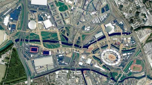
The updates feature new satellite tours of the Olympic Park, shot in May while the final touches were being made to the construction. Parts of London now also have access to new 45 degree imagery.
Village peep-le
The blog posted last week says: "We'll start in the United Kingdom, where the London 2012 Olympic Games opens this Friday. We've released new satellite imagery taken this past May of the Olympic Park and Village.
"In the image above, you can see the final construction touches being added to the open-air Olympic Stadium (lower right)."
Via: Google Maps
