Google Earth’s improved Timelapses show how your city’s changed over decades
Warning: it's an addictive educational timesink

Sign up for breaking news, reviews, opinion, top tech deals, and more.
You are now subscribed
Your newsletter sign-up was successful
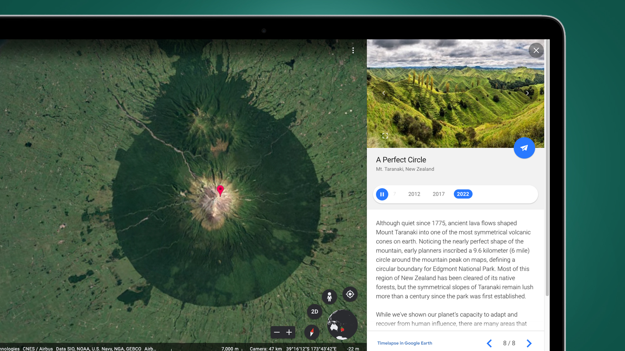
Google Earth may be over 20 years old, but it's still learning new tricks – and its impressive Timelapses feature has just been upgraded with new imagery from the past two years.
Google Earth Timelapses, which are aerial flyovers that are stitched together from 24 million satellite photos taken over the past 37 years, first arrived in April 2021. But the interactive maps have now been refreshed with imagery from 2021 and 2022, which means you can watch how some parts of the world have changed this decade.
To take your Superman-style trip over your chosen city or region, head to Google Earth's Timelapse mode and type your destination into the search box. Timelapse will then run through a yearly aerial snapshot of how the land or buildings have changed from 1984 to last year.
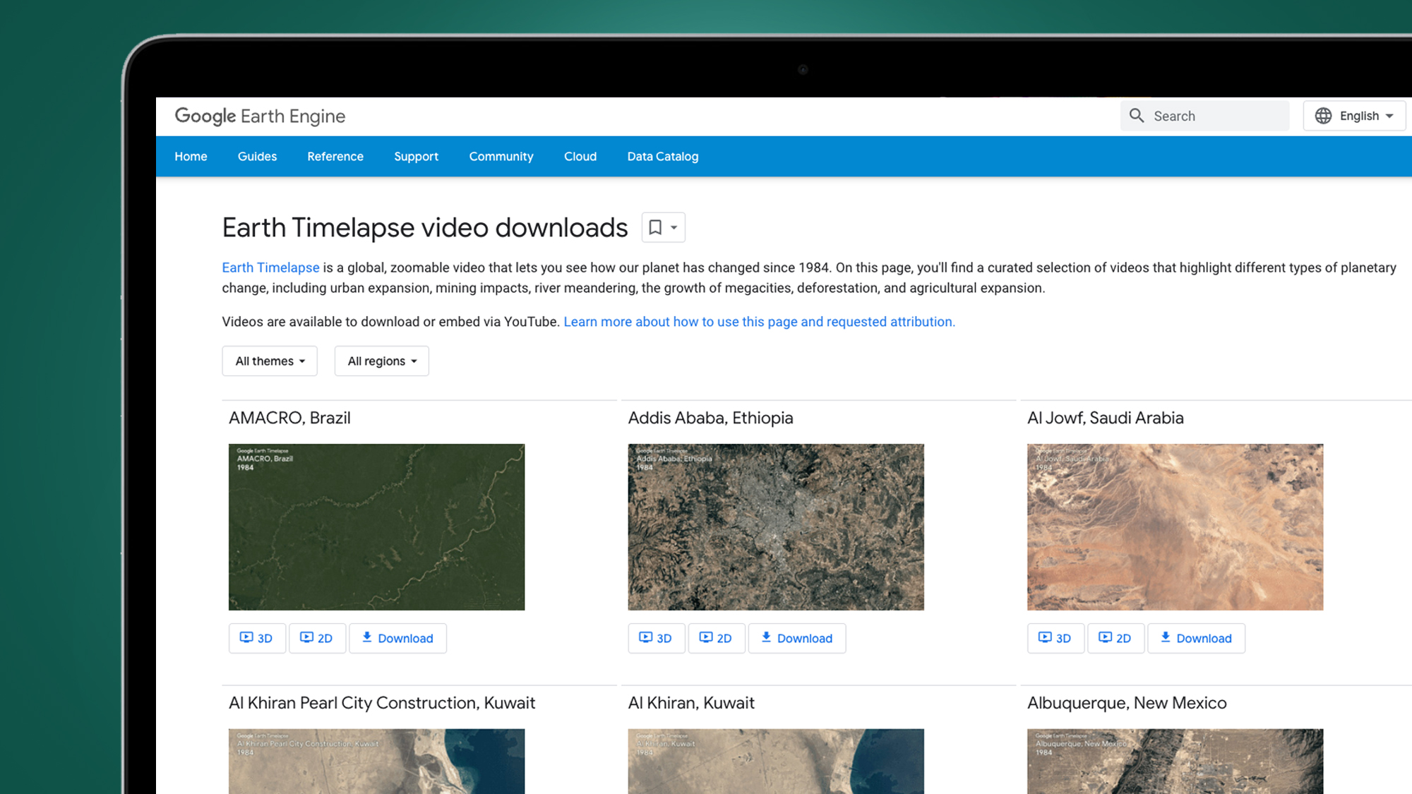
Not sure where to start? Google's also created standalone, downloadable videos of some particularly interesting regions that have changed a lot over the last 38 years, for better or worse. You can find these in the Google Earth Timelapse video downloads section.

Some standouts include the building of a huge solar panel array in Granada, Spain and the arrival of some offshore wind farms in Middelgrunden, Denmark. You can also watch the incredible pace of urban sprawl in Kuala Lumpur, Malaysia, or search the world by themes like 'changing forests' and 'sources of energy' below the Timelapse mode's search box.
Naturally, the resolution of these timelapse maps isn't as high as the ones available in standard Google Earth, but they provide a pretty fascinating overview of how some regions have changed dramatically or, in the case of Kirov in Russia, slowly returned back to nature after humans abandoned their farmlands.
Flying through history
Google called Timelapses "the biggest update to Google Earth since 2017" when the feature launched in 2021. These updates make it a much more useful tool for anyone who wants to use it for education or simply a lunch-hour timesink.
Sign up for breaking news, reviews, opinion, top tech deals, and more.
National Geographic even used the Timelapses mode for a documentary called The Territory, which follows the fight of indigenous people in the Brazilian rainforests against encroaching deforestation.
The reason why Google Earth is able to do timelapse as far back as the 1980s is thanks to open data from NASA and Landsat, which is the world's longest-running Earth observation program. The EU's Copernicus program has also helped thanks to its Sentinel satellites.
Google Earth isn't the only mapping tool that Google's been busy updating recently, either. It's also upgraded Maps with a new next-gen Street View feature called Immersive View currently rolling out on its desktop and mobile apps.
We're looking forward to using that for everything from vibe-checking holiday destinations to planning our photography trips. And if you didn't that was coming, we've also put together a further 10 things you didn't know Google Maps could do.

Mark is TechRadar's Senior news editor. Having worked in tech journalism for a ludicrous 17 years, Mark is now attempting to break the world record for the number of camera bags hoarded by one person. He was previously Cameras Editor at both TechRadar and Trusted Reviews, Acting editor on Stuff.tv, as well as Features editor and Reviews editor on Stuff magazine. As a freelancer, he's contributed to titles including The Sunday Times, FourFourTwo and Arena. And in a former life, he also won The Daily Telegraph's Young Sportswriter of the Year. But that was before he discovered the strange joys of getting up at 4am for a photo shoot in London's Square Mile.