


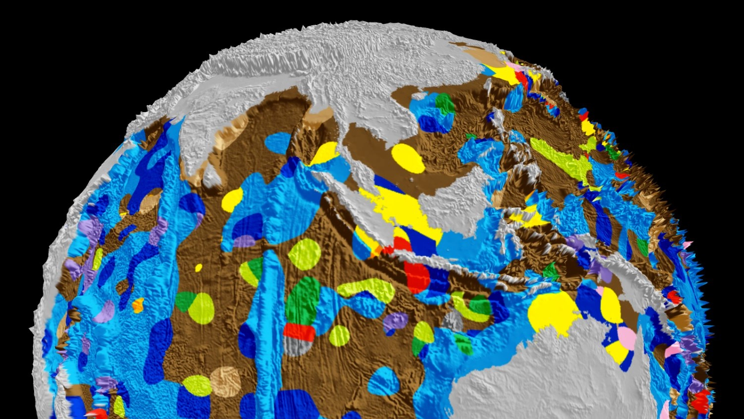
We know less about the bottom of our oceans, the saying goes, than we know about the surface of the Moon. But the first map of the Earth's seafloor in 40 years, and the first one to be digitised, reveals unprecedented new levels of detail.
A team from the University of Sydney used 15,000 samples taken by cruise ships over the last half century to construct a clear picture of the geology of the sea floor around the globe. A sophisticated algorithm was used to turn those point observations into a continuous digital map.
Much Richer
"In order to understand environmental change in the oceans we need to better understand what is preserved in the geological record in the seabed," said lead researcher Adriana Dutkiewicz. "Our research opens the door to future marine research voyages aimed at better understanding the workings and history of the marine carbon cycle."
One of biggest changes since the last map was in the oceans around Australia. "The old map suggests much of the Southern Ocean around Australia is mainly covered by clay blown off the continent, whereas our map shows this area is actually a complex patchwork of microfossil remains," said Dutkiewicz. "Life in the Southern Ocean is much richer than previously thought."
If you'd like to explore the seabed yourself, you can take a poke around an interactive version of the map right here. Alternatively, you can read the paper describing how the map was put together, which was published in the journal Geology, right here.
