Google Maps Street View comes back to India - Here's how to use it
Initially available only in 10 cities

When Google Maps had introduced a decade back its popular Street View service in India it ran into governmental trouble over security issues. The service, which offers 360-degree views of streets using photos taken by vehicles, is not exactly new to privacy troubles across countries. But still it is one of the popular offerings on Google Maps.
And India, after years of trying, Google is relaunching the service starting today. This time Google has joined hands with Indian companies Tech Mahindra and Genesys, who have provided the data for Street View service on Google Maps.
Google has been able to relaunch the service in India after the government tweaked the policy to allow foreign map operators to provide panoramic imagery by licensing the data from local partners.
How to launch Street View on Google Maps

"Our India launch marks the first time in the world that Street View data collection is being brought to life completely by local partners," Google said in a statement. One of its partners, Genesys International, is the first Indian firm to perform street imaging of all major cities in India.
The service would be available in over 50 Indian cities by the end of this year. But to start off, it is available across the ten cities, covering over a total of 150,000 km: Bengaluru, Chennai, Delhi, Mumbai, Hyderabad, Pune, Nashik, Vadodara, Ahmednagar, and Amritsar.
To launch Street View, users need to open Google Maps, zoom into a road in any of the cities where the service is available, and tap the area they want to view. Users can also select the thumbnail with a Street View icon. It's that simple.
Google said it is also making the Street View API available to local developers to help them deliver richer mapping experiences within their apps and services.
Get daily insight, inspiration and deals in your inbox
Get the hottest deals available in your inbox plus news, reviews, opinion, analysis and more from the TechRadar team.
Speed limits on Google Maps in India

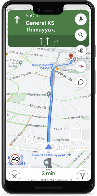
Google also announced partnerships with a couple of local traffic authorities to help improve road safety and reduce traffic congestion. Thanks to which, Google Maps will now show speed limits information shared by traffic authorities, starting with Bengaluru and Chandigarh. More cities will be added to this service in the future, the company said.
Google has also partnered with Bengaluru traffic police to help them optimize their traffic light timings. The pilot resulted in almost a 20% reduction in congestion across all the intersections. Soon, Google said, it will scale this project to all of Bengaluru, and extend this pilot to Kolkata and Hyderabad in the coming months.
"In partnership with local authorities and data aggregators, we will also be providing information on road closures and incidents on Google Maps across eight cities in India, including Delhi, Hyderabad, Chandigarh, Ahmedabad, Kolkata, Gurgaon, Bangalore, and Agra," Google said.
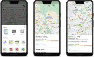
Google also announced its collaboration with the Central Pollution Control Board (CPCB) to help people in India make more informed travel decisions by making available air quality information on Google Maps. This info can be accessed by tapping the ‘Layers’ button at the top right and selecting the ‘Air Quality’ option.

Over three decades as a journalist covering current affairs, politics, sports and now technology. Former Editor of News Today, writer of humour columns across publications and a hardcore cricket and cinema enthusiast. He writes about technology trends and suggest movies and shows to watch on OTT platforms.
Most Popular


