
 Become a TechRadar Insider


Google Earth users can now see the effect of climate change over the last four decades, thanks to its new feature 'Timelapse' --- its biggest update since 2017.
The latest technical tool, announced by Google CEO Sundar Pichai, provides visual evidence of how the Earth has changed due to climate change and human behavior.
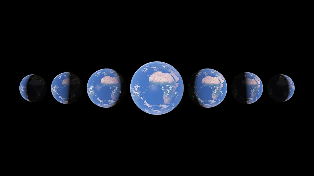
The stunning technical feat takes the platform's static imagery and turns it into a dynamic 4D experience, allowing users to click through Timelapses that highlight melting ice caps, receding glaciers, massive urban growth and wildfires' impact on agriculture.
"Our planet has seen rapid environmental change in the past half-century -- more than any other point in human history. The new Timelapse feature in @GoogleEarth compiles 24 million satellite photos from the past 37 years into an interactive 4D experience," said Sundar Pichai in a tweet.
- Google Maps now offers super-detailed spoken directions
- Google Maps improves transliterations in ten Indian languages
How Google's Timelapse works?
Our planet has seen rapid environmental change in the past half-century -- more than any other point in human history. The new Timelapse feature in @GoogleEarth compiles 24 million satellite photos from the past 37 years into an interactive 4D experience.https://t.co/zDfp7Wn1um pic.twitter.com/wCR7JmIIubApril 15, 2021
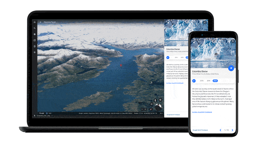
Timelapse compiles the millions of satellite photos taken from 1984 to 2020, an effort that took Google two million processing hours across thousands of machines in Google Cloud.
To explore Timelapse in Google Earth, users can type any location into the search bar --- g.co/Timelapse --- "to choose any place on the planet where you want to see time in motion."
Google said it removed elements such as clouds and shadows from the images, and computed a single pixel for every location on Earth for every year since 1984. All of them were stitched together into a Timelapse video.
Google has worked with experts at Carnegie Mellon University's CREATE Lab to create the technology behind Timelapse, and it worked with them to make sense of what are on view.
"As we looked at what was happening, five themes emerged: forest change, urban growth, warming temperatures, sources of energy, and our world’s fragile beauty. Google Earth takes you on a guided tour of each topic to better understand them," Google said.
Google hoped governments, researchers, journalists, teachers and advocates would analyze the imagery, identity trends and share their findings.
Google ready to work with ISRO
"Timelapse in Google Earth is really a big leap forward. Because now our one static snapshot of the planet has become dynamic providing ongoing visual evidence of Earth's changes from the climate and human behaviour occurring across space and time over four decades," said Rebecca Moore Director, Google Earth, Earth Engine & Outreach.
She added: Timelapse was made possible because of the US government and European Union commitments to open and accessible data. These images were provided by NASA, US Geological Survey, European Commission, and the European Space Agency.
Moore said that Google was open to exploring similar collaboration with ISRO.
“As far as we know Timelapse and Google Earth is the biggest video on the planet of our planet ever created,” she said.
“As you fly through Google Earth, the landscape underneath you is effortlessly animating over these four decades. And now billions of people around the world can experience this from their web browser or even their phones,” she added.
Google said that it would update Google Earth annually with new Timelapse imagery throughout the next decade.
- Want to know about the latest happenings in tech? Follow TechRadar India on Twitter, Facebook and Instagram!
