


FAA rules usually don't apply to motorists, but drivers using Apple Maps near Alaska's second largest airport are best advised to turn off all personal electronics.
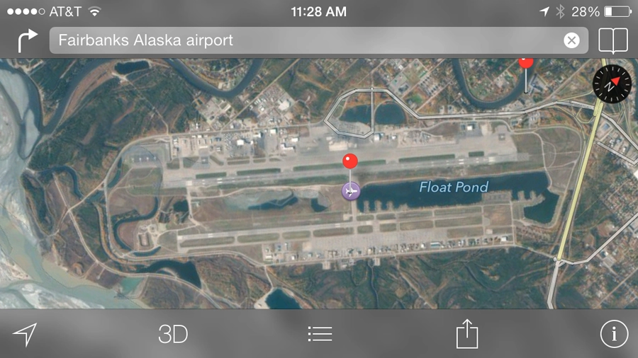
That's because the notorious iPhone app is directing them onto the Fairbanks International Airport runway, according to the Alaska Dispatch.
Incidents in which drivers had their head in the clouds there occurred twice in the past three weeks as motorists followed Apple Maps by driving down "Taxiway B."
"These folks drove past several signs. They even drove past a gate," Melissa Osborn, chief of operations at the Fairbanks International Airport, told the newspaper.
"None of that cued them that they did something inappropriate."
Thankfully, Maps stops short of directing drivers onto the airport's main runway, which the paper wrote is regularly used by large, commercial aircraft like 737s.
Apple Maps a frequent flyer, offender
This isn't the first time that the year-old Apple Maps has been decried as "dangerous."
Australian police have called the app a "potentially life-threatening issue" at the end of last year because it left motorists stranded in the Outback without life essentials: food, water and cell phone reception.
At other times, Apple Maps has had the opposite problem of being too accurate, revealing aerial photographs of high-security military installations that were supposed to be classified.
All of these issues caused Apple CEO Tim Cook to apologize for the Apple Maps chaos and led to the reported firing of the company's senior vice president in charge of the mapping team.
Apple Maps is improving planned mass transit functionality, but this month's incidents in Alaska further prove why Google Maps is still so popular on iOS devices.
