Top 6 things to do on Google Maps and Street View
Are you using Google Maps to its full potential?

1. Create your own art galleries
Google Art Project
Until now, the Google Art Project (pictured above) was a selection of virtual museums and galleries that you could visit via your browser, ranging from the National Gallery of Australia to the Uffizi in Florence.
But Google has now dramatically upgraded the experience. It's easier to find all the art from one artist and some paintings are featured at ultra-high resolution, so you can see the minutest brushstrokes.
Best of all is the introduction of 'User Galleries', in which you create your own virtual collection from the art on show across the world and share it with your friends.
A word of warning, however: building your own virtual gallery is highly addictive and verges on being educational.
2. Get the inside of your building on Google Maps
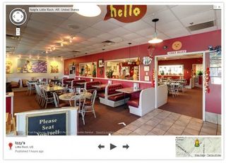
Business Photos
Imagine the uproar if Google extended Street View into people's homes.
Yet, it can do that with business venues — from cafes, retail stores and even corporate headquarters.
Business Photos is a Google service that lets you publish a 3D view of your place of work on Google Maps or Search (via a business listing) to let visitors have a virtual perve.
Get daily insight, inspiration and deals in your inbox
Get the hottest deals available in your inbox plus news, reviews, opinion, analysis and more from the TechRadar team.
It's available in Australia, so contact Google and an approved photographer will be sent over to snap pics for online.
3. Create 3D tours of your street
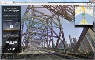
Google Street View Hyperlapse
Pick a starting and an end point covering a street or two on a Google Map and Hyperlapse will create a 3D time-lapsed travelogue of the route.
You can also set the camera to swing round as you travel for a 360° panorama.
By Canadian company Teehan+Lax Labs, Hyperlapse has been praised by Google engineers for providing an original window onto Google Maps.
Open Hyperlapse in your browser, go to the Google Maps window on the top-right, click 'Create your own' and select two points on it. That's it!
Hyperlapse processes the information and turns it into a 3D tour.
The only downside is that each animation is only ever 60 frames, so it works better over short distances — say, over a couple of streets — than over long ones.
4. Navigate inside buildings
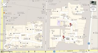
Indoor Google Maps
In the Android version of Google Maps, you can now navigate indoors in various public buildings -- you can also view them via PC browsers.
You see any available indoor spaces when you zoom in on a Google Map and in Australia they range from Adelaide Airport to the IKEA store at Tempe in Sydney.
If you work in a publicly accessible space, such as a big shopping mall or transport hub and you have access to the plans, Google wants you to upload them by 'partnering' with the indoor Google Maps team, which will process them and let you know when they'll be published.
5. Travel to the most amazing places
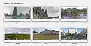
Google Street View Collections
Street View Collections is where Google places its most amazing Street View landscapes, from Everest base camp and the Amazon River and jungle to the palace of Versailles.
6. Snorkel around the Great Barrier Reef
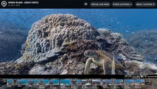
Catlin Seaview Survey
Google's Seaview Survey is Street View under the sea.
It kicked off late last year with an astonishing undersea tour of the coral in the waters around Heron Island in Queensland and has now expanded to include the Apo islands in the Philippines and places like Hanauma Bay in Hawaii.
Most Popular

